
 I was browsing over at the google map directory and found a nice little tool that warrants much more playing with. heywhatsthat.com is a tool to plot the horizon (and name the peaks) from a location of your choosing. you can account for the curvature of the earth, and will also predict how far you can see from a particular location which makes it an ideal tool if... say.... you wanted to build a communications tower. check it out, you'll be impressed.
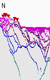
after you have picked your point, be sure and turn on the 'visibilty cloak' so you can see where you can 'see' on the big map. so cool.
I took the time to add in the view from Mount Rose for a friend.
Thursday, October 30, 2008
heywhatsthat.com
![]()
Subscribe to:
Post Comments (Atom)
No comments:
Post a Comment